Просмотр новости
Найдите то, что Вас интересует
 Спутники
 РН
РН SpaceX
 Роскосмос
 NASA
NASA
СпутникиРНSpaceXРоскосмосNASA
The global pattern with a notorious hand in extreme weather has settled into the Pacific, with the next wave of impacts yet to be known as conditions climb to, possibly, historic levels later this year.
The shift to El Niño, a naturally occurring climate pattern in the central and eastern tropical Pacific Ocean where waters become warmer than average, has been underway for months.
Now that the state of the phenomena is solidified, with significant warming in just the last month, the long-term forecast from El Niño, and its potential impacts, is becoming clearer.
In an update from the National Oceanographic and Atmospheric Administration Thursday, the agency affirms El Niño’s influence will hold through the entirety of the 2026 hurricane season, keeping a lid on development across the Atlantic basin.
Current forecasts point to El Niño continuing to strengthen through the remainder of the year with increasing confidence that it will persist into early 2027.
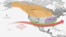
A map of the U.S., Canada, and Central and part of South America showing the affects of El Nino during winter in the Northern Hemisphere. (Image credit: NOAA)
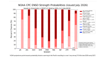
In the near term, there is an 81% chance that the year will finish with an anomalous “very strong” El Niño in place.
As it relates to South Florida, the current hurricane season is expected to produce a below-average number of named systems, likely leading to the quietest in a decade.
The connection from the Pacific to the Atlantic is found in the hostile wind environment created by El Niño. An increase in wind shear produced is a deterrent to tropical development and was a root cause for many seasonal forecasts calling for a below-normal hurricane season.
Colorado State University updated their seasonal forecast Wednesday, again lowering the total number of storms for the season to 9 with only 4 hurricanes anticipated to develop.
These are strikingly low numbers compared to the activity of the last few seasons, including 2020 and 2021 which produced 30 and 21 named storms, respectively.
Should a quiet hurricane season materialize, the winter season could be a stark contrast.
The development of El Niño has been well forecast and its arrival anticipated. What’s becoming clearer is the expected length of El Niño’s influence.
The most recent outlook points to a 97% chance that El Niño will continue through early spring 2027. That duration, even with unknown intensity, will lead to a set-up unlike the tranquil winter months of 2025-2026.
With the likelihood of El Niño conditions firmly in place through next April, South Florida’s winter season would be expected to deliver a cooler, wetter pattern through the traditionally drier months.
A turbulent sub-tropical jetstream would support producing more storminess and an increased chance for severe storms across South Florida.
While it’s too soon to cite specifics, the trend is noteworthy and the resultant impacts are well-placed with the current set-up. Severe storms or not, a wetter trend has already been identified in long-term modeling as a result of El Niño’s expected influence.
The last robust El Niño winter came in 2015-2016, following a hurricane season that sparked 11 named storms with no South Florida landfalls. The closest storm to the area was May’s Tropical Storm Ana, which developed as it was moving away from Florida, north of the Bahamas.
At that time, the National Weather Service in Miami stated that January 2016 was the wettest on record at many South Florida locations. Additionally, South Florida Water Management District determined that the winter of 2015-2016 was the wettest on record for the general South Florida region since records began in 1932.
Nine tornadoes were confirmed in the first three months of the year as multiple severe storms transited the region.
Time will tell if these extremes unfold over the next several months, but with El Niño forecast to rise into the “very strong” category, the influence on South Florida’s weather is more than likely.
The global pattern with a notorious hand in extreme weather has settled into the Pacific, with the next wave of impacts yet to be known as conditions climb to, possibly, historic levels later this year.
The shift to El Niño, a naturally occurring climate pattern in the central and eastern tropical Pacific Ocean where waters become warmer than average, has been underway for months.
Now that the state of the phenomena is solidified, with significant warming in just the last month, the long-term forecast from El Niño, and its potential impacts, is becoming clearer.
In an update from the National Oceanographic and Atmospheric Administration Thursday, the agency affirms El Niño’s influence will hold through the entirety of the 2026 hurricane season, keeping a lid on development across the Atlantic basin.
Current forecasts point to El Niño continuing to strengthen through the remainder of the year with increasing confidence that it will persist into early 2027.
NOAA
A map of the U.S., Canada, and Central and part of South America showing the affects of El Nino during winter in the Northern Hemisphere. (Image credit: NOAA)
In the near term, there is an 81% chance that the year will finish with an anomalous "very strong" El Niño in place.
The NBC 6 First Alert Weather team guides you through hurricane season

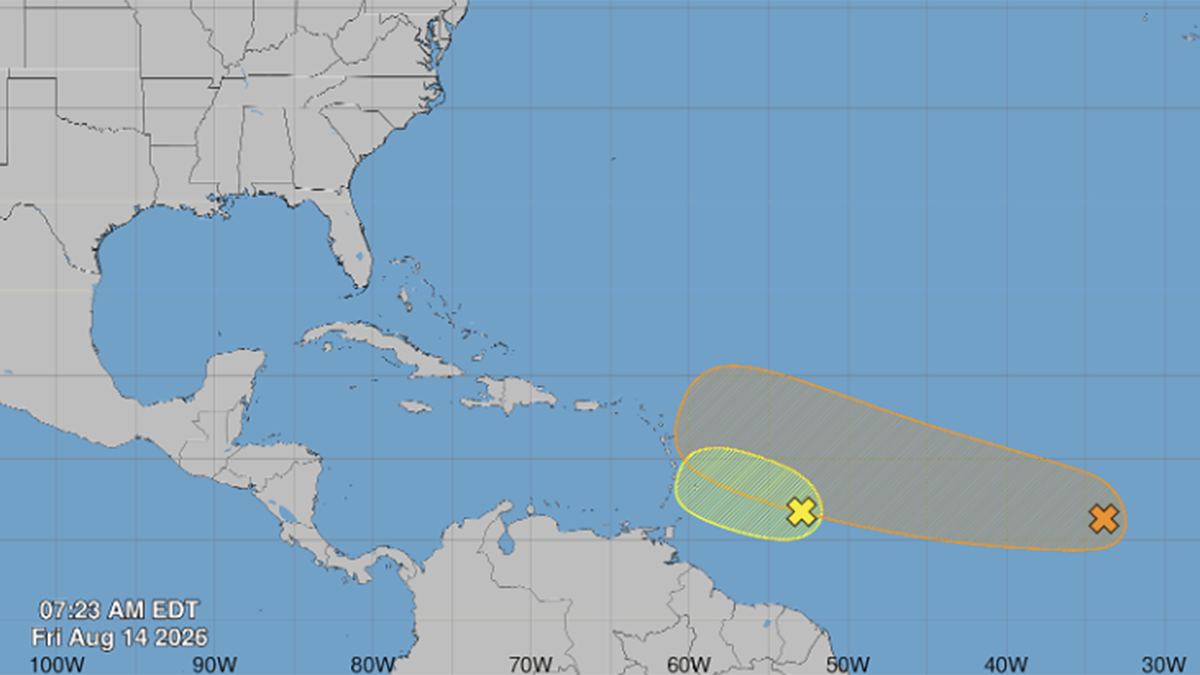
As it relates to South Florida, the current hurricane season is expected to produce a below-average number of named systems, likely leading to the quietest in a decade.
The connection from the Pacific to the Atlantic is found in the hostile wind environment created by El Niño. An increase in wind shear produced is a deterrent to tropical development and was a root cause for many seasonal forecasts calling for a below-normal hurricane season.
Colorado State University updated their seasonal forecast Wednesday, again lowering the total number of storms for the season to 9 with only 4 hurricanes anticipated to develop.
These are strikingly low numbers compared to the activity of the last few seasons, including 2020 and 2021 which produced 30 and 21 named storms, respectively.
NOAA
Should a quiet hurricane season materialize, the winter season could be a stark contrast.
The development of El Niño has been well forecast and its arrival anticipated. What’s becoming clearer is the expected length of El Niño’s influence.
The most recent outlook points to a 97% chance that El Niño will continue through early spring 2027. That duration, even with unknown intensity, will lead to a set-up unlike the tranquil winter months of 2025-2026.
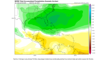
With the likelihood of El Niño conditions firmly in place through next April, South Florida’s winter season would be expected to deliver a cooler, wetter pattern through the traditionally drier months.
A turbulent sub-tropical jetstream would support producing more storminess and an increased chance for severe storms across South Florida.
While it’s too soon to cite specifics, the trend is noteworthy and the resultant impacts are well-placed with the current set-up. Severe storms or not, a wetter trend has already been identified in long-term modeling as a result of El Niño’s expected influence.
The last robust El Niño winter came in 2015-2016, following a hurricane season that sparked 11 named storms with no South Florida landfalls. The closest storm to the area was May’s Tropical Storm Ana, which developed as it was moving away from Florida, north of the Bahamas.
At that time, the National Weather Service in Miami stated that January 2016 was the wettest on record at many South Florida locations. Additionally, South Florida Water Management District determined that the winter of 2015-2016 was the wettest on record for the general South Florida region since records began in 1932.
Nine tornadoes were confirmed in the first three months of the year as multiple severe storms transited the region.
Time will tell if these extremes unfold over the next several months, but with El Niño forecast to rise into the "very strong" category, the influence on South Florida’s weather is more than likely.
| # | Наименование новости | Тональность | Информативность | Дата публикации |
|---|---|---|---|---|
| 1 | NOAA reveals outlook for 2026 Atlantic hurricane season | 0 | 10.01 | 21-05-2026 |
| 2 | CSU's updated hurricane season forecast calls for fewer storms in 2026 | 0 | 19.02 | 10-06-2026 |
| 3 | National Hurricane Center focuses on Central Atlantic for possible development | 0 | 6.38 | 10-08-2026 |
| 4 | It's the start of hurricane season: What to expect | 0 | 15.23 | 01-06-2026 |
| 5 | Forecasters watching potential tropical system in the Gulf | 0 | 10.87 | 15-07-2026 |
| 6 | Hurricane Season: July has produced impactful storms but 2026 won't support it | 0 | 6.38 | 07-07-2026 |
| 7 | John Morales: Forecast shows fewer hurricanes during 2026 season, but don't get comfortable | 0 | 8.24 | 31-05-2026 |
| 8 | Atlantic hurricane season ramps up: What South Florida residents need to know | 0 | 7.3 | 09-08-2026 |
| 9 | Tropical Storm Cristobal forms, as forecasters eye 2 other potential systems | 0 | 16 | 12-08-2026 |
| 10 | National Hurricane Center to test a higher confidence forecast cone this season | 0 | 9.76 | 24-03-2026 |